Child Location Tracking: How to Always Know Where Your Kid Is
Few things calm a parent faster than opening an app and seeing a small dot on a map that says, plainly: your child is at school, or on the bus, or already home. Child geolocation has quietly become one of the most-used features of modern parental control, not because parents want to spy, but because a single reliable answer to "where are they right now?" removes a huge amount of daily anxiety. This guide explains exactly how location tracking works under the hood, what geofences and route history give you, why the dot sometimes "jumps," and how to keep everything running reliably — including abroad and on a low battery.
- A phone finds its position by combining three sources: GPS satellites, mobile cell towers, and nearby Wi-Fi networks.
- Geofences let you draw a circle around home or school and get an instant alert when your child arrives or leaves.
- Route history shows the full path your child travelled during the day, with timestamps.
- Outdoor accuracy is usually 5–20 metres; indoors and among tall buildings it drops, which is why the dot "jumps."
- For tracking to work you need the app installed, location permission set to "Always," and either mobile data or Wi-Fi.
- Tracking works abroad too, as long as the phone has internet via roaming or a foreign SIM/eSIM.
How geolocation works
A smartphone does not have a single "location chip" that magically knows where it is. Instead it blends several independent technologies and lets the operating system pick the most accurate result. Understanding these three sources explains almost everything about why tracking is sometimes pinpoint-accurate and sometimes vague.
GPS (and other satellite systems). The most precise source is the global navigation satellite system — GPS in the US, but modern phones also listen to GLONASS, Galileo and BeiDou simultaneously. The phone receives faint timing signals from satellites orbiting roughly 20,000 km up and calculates its position from the tiny differences in arrival time. Outdoors, with a clear view of the sky, this gives accuracy of about 5 metres. The catch is that satellite signals are weak and easily blocked: thick concrete, underground metro stations, parking garages and dense shopping malls can cut GPS off entirely. That is why your child's dot is razor-sharp in a park but unreliable inside a multi-storey mall.
Mobile (cell tower) positioning. Every phone is constantly in contact with the nearest cellular base stations. By knowing which towers the phone "sees" and how strong each signal is, the network can estimate position even with no GPS at all. In a dense city with towers every few hundred metres, this is reasonably good; in the countryside, where one tower may cover several kilometres, it can be off by a kilometre or more. Cell positioning is the reliable fallback indoors and underground, where satellites fail. It also works the instant the phone powers on, with no waiting for a "GPS fix."
Wi-Fi positioning. This surprises many parents: a phone can locate itself using Wi-Fi networks without ever connecting to them. Google and Apple maintain enormous databases mapping the unique IDs of millions of Wi-Fi routers to real-world coordinates. When your child's phone sees the coffee-shop router, the school router and three home routers nearby, it matches that fingerprint against the database and pins itself down — often to within 10–20 metres, even indoors. Wi-Fi is the hero of city accuracy and the main reason location stays sharp inside buildings where GPS dies.
Phones fuse all three through what Android calls "fused location" and iPhones handle automatically. The system constantly chooses the best mix, which is why you should never disable Wi-Fi scanning to "save battery" — it actually makes positioning both worse and more power-hungry, because the phone falls back to the energy-expensive GPS chip.
Geofences and alerts
Knowing the current location is useful, but most parents do not want to stare at a map all day. The real magic is automation, and that is what a geofence delivers. A geofence is simply a virtual circle you draw on the map around a meaningful place — home, school, grandma's house, the sports club. You set its radius (typically 100–300 metres), and from then on the app watches the boundary for you.
The moment your child's phone crosses that line, you get a push notification: "Arrived at school, 8:42." or "Left home, 7:55." This turns a passive map into an active assistant. Instead of checking the app at 8 a.m. to confirm your daughter reached school, you simply receive the arrival alert and get on with your morning. If it never comes, that absence is itself the signal that something is worth a quick call.
A few practical tips make geofences far more reliable:
- Don't set the radius too tight. A 50-metre circle around a large school campus will trigger false "left" alerts every time the phone's accuracy wobbles. Start at 150–200 metres and tighten only if you get clean results.
- Set zones for the places that matter most — school, home, after-school activities. Three or four well-chosen zones beat a dozen you'll ignore.
- Expect a short delay. Alerts usually arrive within a minute or two, not the exact second of crossing, because the phone batches location checks to save power.
- Use "danger zones" too. Some parents draw a geofence around a place they'd rather their teen avoid and treat any "arrived" alert as a conversation starter, not a punishment.
Route history
Live location answers "where now?"; route history answers "where during the day?" The app records a timeline of points and draws the path your child travelled, each stamped with a time. Open it in the evening and you can see the morning walk to school, the afternoon detour to a friend's house, and the trip home — all on one map.
Why does this matter? For younger children it is reassurance: you can confirm they took the usual safe route and didn't wander. For teenagers it is accountability without hovering — you don't need to text "where are you?" five times, because the picture is already there. And in the rare genuine emergency, route history is invaluable: if a child stops responding, knowing the last several locations and the direction they were heading gives you and, if needed, the authorities a concrete starting point rather than a blank map.
Good route history also smooths over momentary glitches. A single bad GPS reading might place one point in the middle of a river, but seen as part of a continuous track, it's obviously noise, and the overall journey remains clear and trustworthy.
Accuracy and why the dot "jumps"
Almost every parent eventually notices the dot leaping across the map — showing the child two streets away, then back, then inside the building. This is normal physics, not a malfunction, and understanding it saves a lot of needless worry.
Typical real-world accuracy looks like this:
| Situation | Main source | Typical accuracy |
|---|---|---|
| Open area / park | GPS satellites | 5–10 m |
| City street | GPS + Wi-Fi | 10–30 m |
| Among tall buildings | Wi-Fi + cell + reflected GPS | 30–100 m |
| Indoors / mall | Wi-Fi + cell towers | 20–80 m |
| Underground / metro | Cell towers only (or none) | 500 m–2 km, or last known point |
The "jumping" has a few specific causes. In a downtown core, GPS signals bounce off glass-and-steel skyscrapers before reaching the phone — the so-called urban canyon effect — so the calculated position skips around. Indoors, the phone switches between Wi-Fi and cell estimates, each pointing slightly differently. And when a phone has been still or offline for a while, it may show its last known location until it gets a fresh fix, which can briefly look like time-travel on the map.
The practical takeaway: judge location by the pattern over a few minutes, not a single ping. If the dot consistently sits near the school for ten minutes, your child is at school — even if one stray reading put them across the street. Most apps also show an accuracy radius (a faint circle); a big circle means "somewhere in here," a small one means "right here."
What you need for it to work
Geolocation is only as good as its setup, and most "the app isn't tracking" complaints come down to one of a handful of missing pieces:
- The app installed on the child's phone. Location is read from the device the child carries, then sent to your phone. Both Android and iPhone are supported, though Android allows deeper background access.
- Location permission set to "Always." This is the single biggest gotcha. If permission is "While using the app" or "Ask every time," tracking stops the moment the screen is off. It must be "Always" / "Allow all the time."
- Location services switched on at the system level, with high-accuracy / Google Location Accuracy enabled so Wi-Fi and cell are used alongside GPS.
- An internet connection — mobile data or Wi-Fi — so the phone can upload its position to you. Without data, locations are stored and only appear once the phone is online again.
- Battery optimisation disabled for the app, so the system doesn't "freeze" it to save power. On many Android phones (Xiaomi, Samsung, Huawei, Oppo) this is the difference between updates every minute and updates every few hours.
Spend five minutes confirming these once, and tracking becomes something you never have to think about again.
Geolocation abroad and in roaming
Holidays and trips are exactly when knowing your child's location matters most — unfamiliar city, foreign language, big crowds — and the good news is that geolocation works abroad the same way it does at home. GPS satellites are global and free; they don't care which country you're in. Wi-Fi databases cover most of the world's cities too.
The one thing that changes is how the position gets uploaded to you, because that needs internet. You have three options abroad:
- Data roaming on the home SIM. Simplest, but check the price — some operators charge heavily outside bundled regions.
- A local SIM or eSIM in the destination country, which is usually the cheapest data and works perfectly with the tracking app.
- Wi-Fi only. Hotel, café and airport Wi-Fi will update the location whenever the child connects; between hotspots the position simply pauses and catches up later.
One nuance: with a local SIM, geofences around home obviously become irrelevant, but you can quickly draw new ones around the hotel, the resort or a meeting point. And because GPS itself never roams or charges, even on Wi-Fi-only the actual position is just as accurate abroad as at home — only the update frequency depends on connectivity.
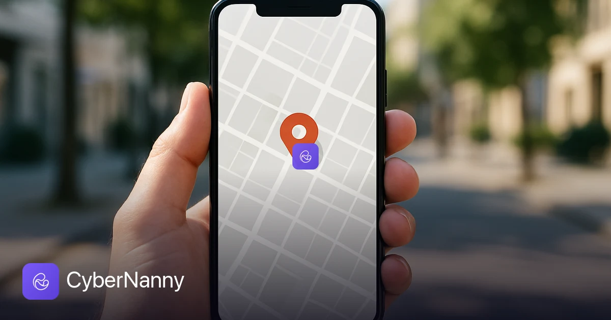
Try CyberNanny for free
See where your child is on a live map, set up geofences for home and school, and review the day's route — all in one simple app.
Install the appFrequently asked questions
Will location work without internet?
The phone can still determine its position offline — GPS satellites need no internet at all — but it can't send that position to you without a data or Wi-Fi connection. In practice this means that while your child is in a dead zone (a basement gym, a remote trail, an underground station), the app keeps recording locations locally and shows you the last point it managed to transmit. The moment the phone gets online again, the stored points upload and the map fills in the gap. So a "frozen" dot usually means "no signal right now," not "tracking stopped."
How accurate is the location, really?
Outdoors with a clear sky, expect 5–10 metres — accurate enough to tell which side of a street your child is on. In a normal city, 10–30 metres is typical. Indoors or among tall buildings it widens to 30–100 metres, and deep underground it may fall back to a cell-tower estimate of several hundred metres. Always read the dot together with its accuracy circle and over a short span of time: a steady cluster of points near a place is far more trustworthy than any single reading, and it filters out the occasional stray "jump."
Does it work when my child is abroad?
Yes. The positioning technology is global — GPS and Wi-Fi databases cover virtually every country. The only requirement is that the phone has internet to upload its location, via data roaming, a local SIM/eSIM, or Wi-Fi. Many parents put a cheap local eSIM on the child's phone before a trip precisely so live tracking keeps working without roaming bills. The position itself is just as precise abroad as at home; only the update frequency depends on the connection.
Will tracking drain the battery?
Modern apps are far gentler than the old "constant GPS" reputation suggests. By relying mostly on Wi-Fi and cell positioning and only waking the GPS chip when needed, a well-built tracker typically adds only a few percent of battery use per day — comparable to a maps app you open occasionally. Counter-intuitively, leaving Wi-Fi scanning on saves power, because it spares the hungry GPS chip. If you do see heavy drain, the cause is usually a misconfiguration: location stuck on continuous high-accuracy, or battery optimisation toggling the app on and off all day.
What if the phone is switched off or out of battery?
A powered-off phone can't report anything, so the app will show the last location it had before shutdown, with that timestamp. This is exactly why route history and the "last seen" time are so valuable: even if the battery dies on the way home, you can see where your child was and which direction they were heading. Encourage older kids to keep a charge above 20%, and consider a small power bank in the school bag for long days — it keeps both the phone and your peace of mind alive.